Earthcaches

I am a proud

Sunday, July 29, 2012

Barefoot Landing Caching - North Myrtle Beach, SC

Elwood the Lizzard
Ryan and Beth
Intercoastal Bridge at Barefoot Landing
sumajhuarmi
Alligator cache
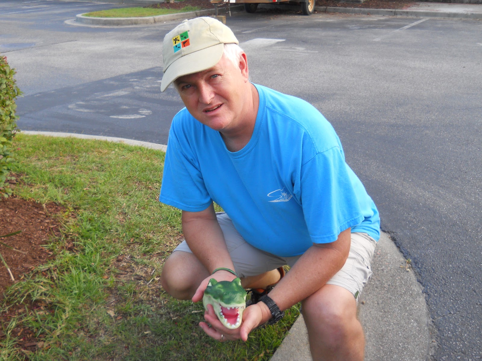
We spent the past week at North Myrtle Beach, SC. We went in together with one of our daughters and her family to rent a condo. Our younger daughter also joined us. My wife, sumajhuarmi, and I took off one evening for a one-hour caching run. The best and closest concentration of geocaches were across the Intercoastal Waterway from our condo and in the Barefoot Landing shopping and entertainment area.. The first cache was entitled, See Ya Later, Alligator (GC3PW6Z). It was a pretty quick find in the parking lot shrubbery. I really liked the alligator head container! From there we took off to one entitled, Jake and Elwood Sing the Blues (GC3PW7K), located near The House of Blues theater. It took us down a nice fenced-in boardwalk through a swampy area. As we were approaching ground zero with my GPSr out a family rounded the bend and stood there stunned. I was not sure why they would act this way so my first thought was that they weren´t muggles but geocachers letting us finish finding the cache before approaching. Then sumajhuarmi told me to look at something. It was a foot and a half long lizzard crawling along the boardwalk. The lizzard was obviously more concerned about getting away from us than anything else. The family thought it was a small alligator at first. Finally Elwood (we named him so) found a hole in the fence and got back into the swamp. With all the attention on Elwood we were able to find, sign, and replace the cache without anyone being the wiser. We continued on down the trail and over by restaurant row to find another cache before heading back to the car. We drove around behind the Alabama Theater to find the last cache of the evening before the sun went down. It gave us a great view of the Intercoastal Bridge leading into the Barefoot Landing Resort area. It was a small lock-n-lock which allowed me to drop off a travel bug I brought in from South America. We enjoyed the Barefoot Landing area so much that we took the rest of the family back for ice cream later in the evening. We enjoyed seeing the fish and turtles, walking around and visiting the shops, and our two-year old grandson enjoyed the merry-go-round. Once again geocaching took us to some places we would likely have never visited otherwise.

Sunday, July 22, 2012

Puzzled in Peru --- My favorite puzzle cache

Inca Sunset
The end of the line
Coastal view
Sumajhuarmi
We stepped out of the doctor's office in the Miraflores district of Lima and switched on the GPSr. In no time we had signal and saw that the cache was .91 miles from where we stood. We had been planning to grab this cache in conjunction with the trip to the doctor. We set off following the needle to the northeast in search of a relatively new puzzle cache entitled Inca Sunset (GC3MR06). We zigzagged from one city block to another as we worked our way over to the coastline. About a month earlier I worked out the on-line puzzle from home. Now that we were in Lima it was time to solve the puzzle by tracking to the set of coordinates revealed when the puzzle was assembled. Our walk brought us to the park that sits atop a long stretch of cliffs along the Lima coast. From there you can look down on a ocean-side road and the rocky beaches of Lima. Here many people walk and run early in the morning and in the evening. We tracked to the end of the bike trail to find ground zero. From the photo revealed when we solved the on-line puzzle we knew what type of object we were looking for. My GPSr took me around behind a tennis court perched up on the cliff overlooking the sea. My wife, sumajhuarmi, had another idea. It turned out to be the right idea too. She quickly had the cache in hand. The container was unique and well suited for the environment. We signed the log before snapping a few photos of the area. Geocaches come and go along the coast in Lima. The professional grounds keeping in the parks is such that it is hard for a cache to survive for long. This one has a good chance of making it longer. It is well-hidden. The only danger is that an overly anxious geocacher who doesn't wait out a muggle sitting on a nearby park bench could give away the cache. If you are in Lima be sure to solve this puzzle and find this cache. The view of the Inca sunset is well worth it. A special thanks goes to Luke Robinson for the great sunset photo.

Sunday, July 15, 2012

Geocaching west of Cruzeiro do Sul, Acre, Brasil

A few week ago I told you about our flight to Cruzeiro do Sul, Brasil. We had a great time there. We spoke with some travel agents about the wisdom of promoting tourism in the region with geocaching. None had ever heard of it. Some were interested and others were not interested in the idea of geo-tourism. There are a few here thanks to GTAbusquedor so we explained how if these attracted any tourist how it would be worth it to place a series up and down the river and let tour guides take folks to find them in their boats. I hope there is a positive response. While visiting friends we took off to find the caches that have been placed in the area. With my friend we headed out to find CFL (GC3N3X7) near a training institute for church leaders.   The pastor who owns the land gave local geocacher cheysol permission to place this cache. Nonetheless it was good that we stopped by to ask permission since it is on private property. He gave it and we had a good time finding the cache and visiting with him. So much so that on Sunday we returned to visit church services. My friend gave me the cache information as this cache was not published. This was my friend's first cache placement and he was disappointed that he'd been waiting for over a week for the reviewer to approve or provide some type of feedback. We went for it anyway. It was great to get out into the countryside for a while. Don't go looking for this one though! Unfortunately my friend became frustrated and archived the cache when the reviewer  required he answer a bunch of unnecessary questions, some of which he had explained clearly in the cache information. 

Later in the week I took off with cheysol, and sumajhuarmi to find another one of GTAbusquedor's caches. This one is called Bamboo - Igrape Preto (GC3NR0Z). It was a weekend so when we got to this local watering hole (in every since of the word because it was a small lake with numerous drinking establishments around it) we followed the GPSr needle back behind the area where folks were swimming to cool off The name Bamboo says it all. We looked for about five minutes before coming up with the cache. I recommend that you make this a weekday cache as the quantity of muggles there was high. I hope you get a chance to visit the Brazilian jungle near Cruzeiro and to check out the caches here!


Sunday, July 8, 2012

Geocaching: OVNI "UFO" Cache - Peru Jungle


Have you ever seen a UFO? In Spanish they are called OVNIs. It's almost a literal translation of Unidentified Flying Object (Objecto Voladora No Identificado). As we were coming out of the foothills at the base of the Andes Mountains in Central Peru, heading into the jungle, we hit the first stretch of fairly flatland you see after having traversed the mountains. We came through the narrow canyon called El Boquerron and suddenly we were confronted with an OVNI! Someone has built a restaurant in the shape of a flying saucer with a big parking lot in front. It didn't look like it was the most popular eatery around. At the time we stopped there were no customers. In fact, there appeared to be two men inside the restaurant (it was an open-air restaurant) and they were having a worship service. They were singing and praying. We didn't want to disturb the church of the flying saucer so we steered clear. GTAbusquedor, a Pucallpa geocacher, had placed a cache in the area. Thankfully it was not right at the restaurant. We didn't see the color of the men inside the restaurant. They could have been green for all we know. Be sure to check out OVNI (GC3C2T0) if you get the chance to visit near Aguaytia, Peru. If you travel to Pucallpa, Peru it is only about three hours in car or van to this tourist area on the main highway back to Lima.

Sunday, July 1, 2012

Hiking the Inca Trail to Machu Picchu


Geocacher low_rider73 shares about hiking the Inca Trail:

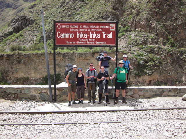
In December 2011, my brother-in-law came to Peru to visit us.  He and I have talked for years about hiking the Inca Trail together. Although December isn't the best time to hike the trail for the rain, we also knew that it would be less crowded due to it being the "off-season".
Once he arrived in Peru, we headed up to our house in Huaraz and started preparing for the hike.  We did several hikes in the Huaraz area and ran several times to prepare for the 4 day journey that we were about to embark upon.  We knew that one of the greatest challenges of the Inca Trail is the altitude.  Therefore, several of our hikes outside of Huaraz took us to higher elevations than what we would see on the Inca Trail.  After the preparation, we set out on our journey.
First, we drove to Lima and boarded a flight to Cuzco.  Most travel guides recommend that visitors spend at least a day or two in Cuzco to acclimatize to the altitude, but we knew that we were already acclimatized, and so we arrived in Cuzco in the afternoon and planned to leave bright and early the next morning.  While in Cuzco, we had to meet with the guide that was going to lead us through the trail, and so we did that, visited the Plaza, and got a bite to eat before getting some rest before the big day ahead of us.
On the first day, we left Cuzco and headed off in a van to the trail head at kilometer 82.  From there, we set off on foot to begin our adventure.  Unfortunately, the entrance to the trail is extremely unorganized, and so we waited for a while before it was our turn to pass through the gate and cross the bridge over the Urubamba River.  The first day is classified as "easy" and as a day of acclimating to the altitude.  We found that day one was described correctly and we were surprised at how quickly the time passed.  We stayed together as a group and hiked at a slow, but comfortable pace for the first day.  We only hiked 12km the first day.
We hiked with a group of 7 "tourist" and our guide.  We also had 7 porters (carrying all of the tents, food, cooking supplies, etc…) and a cook.  Normally the cook and porters raced ahead and we would see them either at the spot to stop for lunch (where they normally had the "kitchen tent" and "dinning tent" already set up and lunch mostly prepared), or at our final destination for the day (our camping spot).  The surprise for me was that the porters set up and took down everything each day.  Therefore, all we had to do was to hike (carrying our packs) and make it to lunch on time or to the campsite each night.  Because we weren't carrying tents, food, cooking supplies, etc…, our packs weren't that heavy.  I carried my own bedding, clothes, snacks, water, etc…, but it wasn't bad at all.
Day 2 is known as the "Challenge" and it lived up to its name description too!  We set out and started climbing up towards the "Abra de Warmi WaƱusca" (or Dead Woman's Pass), which sits at an elevation of 4,200m (or 13,776 ft.) above sea-level.  We learned quickly that the hardest challenge wasn't the climb from 3,100m (10,137 ft) to 4,200m, the challenge was that it was all stairs!  It was like some mean joke that the Incas wanted to play on the rest of the world!  That day we traveled around 10km, but the vast majority was either going up stairs, or going down stairs.  Doing it in the rain just added to the fun!  By the time we made it to the top of the pass, the rain was coming down pretty hard!  Obviously, on this day, we didn't stay together as a group because some people were able to climb at quicker rates than others.  Therefore, my brother-in-law and I set out and met up with the rest of the group when they made it to camp later that afternoon.  Needless to say, we were all quite exhausted and ready to rest at the end of day 2!
Day three is known as "unforgettable" because you travel through some beautiful areas of the Andes Mountains and the high rainforest.  We also saw more and more ruins the closer we got to Machu Picchu.  The unfortunate thing was that the rain and clouds prevented us from seeing some of the breathtaking views that we were told about.  However, the rain and clouds did make walking through the high rainforest seem more legit than if it were a clear and pretty day.  This day, we covered about 17km of terrain and we tried to stay together more as a group so that our guide could tell us about the ruins that we were seeing.  Typically, what would happen is that those of us who were quicker would hike on ahead and sit at the next stop to wait on the rest of the group.  The cool advantage that we had was that we could listen to the other guides teaching their groups about the location and learn more about the site than just hearing about it from our guide.  (Our guide was good, but each guide tells the story differently and includes or forgets certain details.)  On the 3rd night, we camped at 2,700m (8,829 ft.) and enjoyed the somewhat warmer weather.
Day four was the big day.  We woke up early and hit the trail quickly so that we would be some of the first to set out that day to get a glimpse of Machu Picchu from Inti Punku (or the Sun Gate) as the sun was rising.  They don't allow groups to start any earlier than 5am, so we all stood in line at the entrance gate waiting for the opportunity to begin our final day of hiking and to see Machu Picchu.  After the previous 3 days worth of hiking, we were all tired, but the adrenaline was enough to keep everyone moving at a good pace.  When we arrived at Inti Punku, it was cloudy and we couldn't see anything.  However, we sat around for a while and patiently waited until the clouds began to break and the beauty of Machu Picchu was revealed.  Most people there were seeing Machu Picchu for the first time ever, and so it was a special experience for them.  I had been to Machu Picchu once before (a little over a year before this trip), and so I wasn't seeing it for the first time, but it was still a spectacular site.
After taking pictures and such, we set out to finish our hike down to Machu Picchu and to enter the park.  The unfortunate thing is that you have to walk into the site, walk down through it, and out the front gate to be "officially" allowed back in.  It seems to be a very strange and inefficient way of doing things, but I guess that it works.  We checked our hiking backpacks at the storage room at the gate and entered officially back into the site so that we could begin our little tour with our guide.  After an hour or so, he turned us loose and we were on our own.  Since I had already been there, my goal was to see something new (which ended up being an Inca bridge constructed about a 20 minute walk behind the site) and to hunt for a geocache that has been places there (Para Emmy-n-Sapphie - GC19941).  My brother-in-law was interested as well, and so he accompanied me to the bridge and then back to the main site to hunt for the cache.  Unfortunately, my GPSr wasn't being on its best behavior, and so we walked around for quite a while before it finally zeroed in on the cache location.  After searching around for a few minutes, my brother-in-law actually located the cache, we signed the log, and off we went.  By that time, it has started raining, and so we took off to the gate to get our packs and to get on a bus down to Aguas Calientes to catch the train out.  There are other caches around Machu Picchu (like an Earth cache) that I would have loved to have located as well, but when the rain started to pour, we decided that we had been wet for long enough and that it was time to get out and get a shower!
All in all, it was a great adventure and I highly recommend it!  Machu Picchu is a beautiful site with lots of "mystery" and history to be enjoyed by all!  By all means, if you ever visit Peru, plan to visit Machu Picchu.  If you have the time and health, I would also recommend that you hike the Inca Trail.  And, if you are a geocacher, be sure to bring along your GPSr because you are bound to rack up a few smiley's from your visit!  (There are also come cool caches in the Cuzco area, but we weren't there long enough to look for them - I will have to hunt those down on a future trip!)

Sunday, June 24, 2012

A Cruz do Cruzeiro (Cruzeiro do Sul, Acre, Brasil)

It started with an international flight aboard a small single engine plane from the jungle city of Pucallpa, Peru going due east to the city of Cruzeiro do Sul in the state of Acre, Brazil. Sumajhuarmi and I were accompanied by a non-geocaching friend who was interested in the sport. Our flight departed from the Pucalpa airport about noon and flew at 7500 feet above sea level. Below we had nothing but a carpet of jungle for as far as the eye could see. The distance we flew was about 120 nautical miles but with the headwind we had it meant about 1 hour and 10 minutes in the air. As we neared the border between Peru and Brazil we saw a spectacular sight. Cerro El Cono, a perfectly cone-shaped mountain rises up out of the flat jungle canopy and can be seen for miles around. Soon after passing El Cono we crossed into Brazilian airspace. We crossed some more small mountains called the Sierra del Divisor. Click on video to see a beautiful video of El Cono, the Sierra del Divisor and what we flew over. We flew for another 15 minutes or so before we began to see small clearings and an occasional hut. Finally we could see the Cruzeiro do Sul airport in the distance. We landed at a modern but small airport. Once the plane was positioned, engine off and the brakes set we unloaded our things and carried them across the tarmac to the airport. Since this is not an international airport and we were a chartered international flight we had to track down the Federal Police to get our passports stamped. Since they aren't used to chartered international flights they must have suspected us. They questioned about who we were, where we are from in our native countries, where we worked, who paid our salaries, how much we made, where we were staying, who we would see and so on. They they went through all our luggage with a fine toothed comb. Our time with the Federal Police took longer than the flight from Pucallpa. When I told them what geocaching was they found it hard to believe that a person would take a vacation and fly a chartered flight internationally to look for a geocache. Even with the explanation that we operate a small non-profit in Peru which promotes geocaching they had a hard time getting their minds around the idea. I guess this made them all the more suspicious. Since we were clean and since we had legitimate ten year tourist visas to visit Brazil, they let us through. We met a friend who took us from the airport to our hotel in town. What a nice city! Rolling hills, cool breezes, the Jurua River, a beautiful new bridge over the river and more. Check out the link and listen to some Portuguese if you want to see a little of the city. We knew that GTAbusquedor had placed a cache here so high on our list of activities was to find it. Off we set to find the cache, A Cruz do Cruzeiro (GC3NNG2) . From the center of town it was just a short hike up the hill to find the cache. If one wishes to take a motor bike taxi one can pay a small fee for the ride up to the top of the small hill. There was a radio tower and some buildings at the top. This is a hill tourist visit to get a good view of the city and the Jurua River, including the new bridge. Our GPSr was true and took us to the site. Within a minute we had the cache in hand, signed it, got some pictures and then stopped to enjoy the beautiful view. Thanks GTAbusquedor for the opportunity to come to this place. I can't wait for tomorrow to head out looking for two more caches just a little way out of town. This is my first cache in Brazil and this is definitely one of the western-most caches in the country.

Sunday, June 17, 2012

Geocaching: Craighead Caverns - The Lost Sea of Tennessee


My mother grew up in these parts of the knobs of Monroe County, Tennessee. Many folks go further and call it "East Tennessee" by habit. Even though I was raised in North Carolina, I spent a number of summers on my grandparent's farm on Kinser Branch, just about three miles as the crow flies from Craighead Caverns, better known today as "The Lost Sea". I grew up hearing the stories of the cave. A few years after my folks moved into the hills just west of the knobs a Pleistocene jaguar's remains were found in the caverns. This happened in 1939. Further exploration revealed that the caverns had been used by the Cherokee Indians and by Confederate miners extracting saltpeter to make gun powder for the war effort. The entrance to the cavern had even been turned into a tavern for drinking and dancing a one point. In the 1905 a thirteen year-old boy exploring the caverns discovered a small entrance that took him into a large room with a body of water. His lantern would only illuminate so far but as far as he could see and as far as he could throw balls of clay there was water or the sound of clay hitting the water in every direction. By the time he convinced his father to come see it the water had risen and the entrance way to the large room was lost. Several years later other explorers found the entrance and re-opened the quest for the Lost Sea. The large underground lake is considered to be the second largest in the world and the largest in the USA. It's worth a visit to anyone traveling through East Tennessee. Today all you have to do is follow the signs from any direction that lead to The Lost Sea. The tour includes a tour of the several rooms that are open to the public, a chance to experience 100% darkness, stories about the caverns and a boat ride on glass-bottomed boats affording you a view of the blind fish. When we went a guide told us about a workman who was down in one of the holes not too far from the tourist walking path. He was outfitted with a red jump suit. He'd gone into the hole to repair some of the lighting system. A tour came along about the time he came up out of the hole. One women nearly had a heart attack and was convinced that the devil was coming up out of the ground to get her. By the way, the area has its share of geocaches too. The closest one to the caverns is right on the property. Be sure and find the micro called Wishing you Well (GC359EA). Yeah, the name says a lot about this particular hide. If you get the itch to see some beautiful back country roads, head back through the knobs about three miles until you find Middlecreek Cache (GC1EAFH). It's right down creek from Kinser Branch where my folks used to live!