Earthcaches

I am a proud

Sunday, September 12, 2010

My First Earthcache


I've been looking at this place for 13 years. I was amazed by it even before I ever heard of geocaching. Recently I got the idea to create an earthcache at this location. I finally did it! We took our daughter to visit one of her favorite places. We went to the Indian Market in Otavalo. While there she got to barter for the things she bought. She loves doing this and is very good at it. We also ate at her favorite place, The Pie Shop. This is a shop that has every flavor of pie you can think of. For $1 you can have a huge slice. Add 50 cents to get a scoop of ice cream. It is good. On our way back from a visit to the Indian market in Otavalo we pulled off on an overlook viewing a dry gulley that divides the eastern side from the western side of the central valley near Tabacundo. From this overlook one can see the earthcache location.

For those that aren't familiar with earthcaches, these are locations that are of geological significance. One must arrive at the prescribed coordinates, see the geological feature, from the cache page and sometimes from the location learn about the particular geological feature and prove that you were there by performing some calculation or analysis related to the earthcache.

As we approached the overlook from the north we had to use caution getting off the road and into the overlook parking. The overlook is in a curve in the highway and Ecuadorian drivers fly around the curve, some even passing others while in the curve around the mountain. Once we parked we gazed out into the dry valley before us. The valley leads to the east and points towards the Cayambe volcano. This particular day we couldn't see more than a little bit of snow for the clouds that covered her. At the coordinates the geocacher is standing next to a cross placed in memory of Freddy Sadvedra, a victim of an automobile accident at this spot. I don't know for sure but in all likelihood this man may have run off the road and over the cliff. The date on the cross was April 25, 2009. From this location we could look to the south and see the geological fold in the earth's sedimentary strata. I admit that this will be something of a spoiler. That's alright. To get credit for the cache find the geocacher has to locate and see the fold, identify what type of fold this is, identify the major terrain feature at a bearing of 90 degrees from there and then, if willing, post a photograph of himself and his GPSr but not with the fold in the background. Cochasqui Fold (GC2DHJA) is sure to be a fun cache.

Earthcache.org seems to be pretty strict on only allowing caches where there is proof that the hider has the permission of the land manager. They were requiring a copy of the written permission. In this case it is a public overlook parking so I don't think it will be a problem. At any rate I submitted the cache and a week later it was approved and is up. Happy Earthcaching!

Congratulations to FreeCuba for the FTF. Love the family picture!


Sunday, September 5, 2010

Caching with Volcanoes


This was one of those rare crystal clear days with hardly a hint of clouds in the sky. I had planned to go find and hide a cache so I was pleased at the great vistas of all three volcanoes that you can see from certain vantage points in Quito. I parked my car and tracked to the intended FTF cache find but after 30 minutes of searching I decided that this level-one difficulty hide had been muggled or was much harder than indicated. I plugged in an alternate cache and set out on the .5 mile hike. The trails were beautiful. Just as I crested one ridge I caught a view of Cayambe Volcano. I was glad I had my camera. What a view. A little further down the trail I came to an overlook viewing east into the valley and there in all its majesty was the Antisana Volcano. A little further down the trail as I descended gradually towards the cache I caught a view of the Cotopaxi Volcano. Antisana, unlike the cone shapes of Cayambe and Cotopaxi, is a crater volcano where the top blew off many many years ago. Whereas Cayambe and Cotopaxi are visible once every week or so, Antisana rarely comes out of the clouds. What a view. Soon my GPSr was telling me I was at the location. Just as the cache description said, I had to watch over my left shoulder for muggles that could be taking pictures on a wooden balcony built out over the cliff some 300 feet above me. No one was there when I started the search. I had to climb back into the bushes near the edge of the incline that became the cliff. Suddenly I heard voices from above. Someone was at the overlook. Down in the bushes like I was I knew they couldn't see me so I continued the search. Suddenly something red came into view as I probed the grass. There it was. Vaca Frita (GC24HP6) is part of a series lauding Cuban cuisine. Within the was a recipe for this tangy Cuban dish. I signed the log and crept out of the bushes so as not to attract attention from muggles above. The hike took about 20 minutes on a beautiful trail. I was in search of a place to put in a new cache. Soon I found the right spot, marked the coordinates and dropped a geocoin that I'd brought back from the US. Time to get home. What a beautiful morning in Quito!

Sunday, August 29, 2010

Hiking in the Eco Reserve above Papallacta, Ecuador


There is a group of us who plan camping and hiking outing every two months or so. We recently went to the ecological reserve above the thermal baths at Papallacta, on the east side of the continental divide about two hours out of Quito. We arrived around 11 a.m. just as the rain started to fall. We ate a quick lunch in the car, got into our rain gear and backpacks and off we went. The guard allowed us to park and camp near the control point at 12,200 feet above sea level so our hike from our campsite took us up a number of switchbacks as we ascended to the first series of high mountain lakes. The trail grew increasingly slippery with the rain but the scenery was beautiful nonetheless. We climbed past waterfalls until finally arriving at a large unnamed laguna. There my two companions fished for a time while I prepared coffee on my light weight propane stove. The rain continued. This particular lake was at about 13,000 feet above sea level and my friends caught nothing. As we worked our way back towards our campsite we stopped at Laguna de Banos where they tried their fortune again. We all were hoping for a trout supper. I head ahead on the one hour journey back to the camp. I wanted my tent up and ready before sunset. As I descended from the lake region the rain stopped and I caught the first view of the day of the Antisana Volcano. Since I was ahead of my friends I was able to hide a cache near where we were pitching our tents. It is Campsite (GC2CKNX) hidden at 12,200 feet above sea level. We were all wet and with the setting sun came the cold. After preparing supper on my Coleman camp stove, eating and cleaning up and then using my propane stove to dry out my socks and boots, we were ready to get in our sleeping bags as the temperature dropped to freezing. Freezing in July close to the equator! Not uncommon at these altitudes. I snuggled into two sleeping bags to defend against the cold. Sometime during the night I woke and thought that someone was shinning a bright light on my tent. At first I thought my friend in the next tent was playing a trick on me. When I got out of my sleeping bag to check it out I found it was a bright full moon shining in a cloudless sky. As I stepped out into the crisp, cold air I was struck with the beauty of the Antisana Volcano. Antisana was shy during the day, hardly doing more than peaking out from the clouds. Her she was in all her splendor in the moonlight. What a sight! The next morning after breakfast we headed up a different trail. After several grueling hours of climbing we were again at 13,000 feet above sea level. Realizing that we would have to go off the gravel road and into the paramo we decided to head back. The paramo grass is thick and the ground after all the rain was marshy. We hadn't seen a vehicle all morning. Just as we turned to head back a pickup truck came along heading our way and we thumbed a ride. When back at our camp we decided to head up another trail to find another lake. All totaled we hiked about 12 kilometers, climbing all but three of them. Hopefully someone, a tourist most likely, will find the new cache, the only cache in this area.

Sunday, August 22, 2010

Ryan's Arrival Travel Bug

I recently celebrated a birthday. One of my gifts was travel bug tags. I'm new to this TB stuff so I decided to hold the tag until getting to the US to launch it. With the birth of my third grandson I decided to release one in his honor. I found a photo keychain and placed a photo of Ryan in it. This cache is my way of giving thanks to the Lord for the birth of Ryan Ethan Abbott on 21 June 2010 at the High Point Regional Hospital. Ryan's Arrival (TB33FDM) was released in cache RDU Travel Bug Hotel (GCB649) near the Raleigh-Durham airport in North Carolina with instructions that it should travel to Quito, Ecuador. We are spending a month in North Carolina and then we will return to Quito where I'll be waiting the arrival of the travel bug. I wonder how long it will take for this to get there?

Sunday, August 15, 2010

Caching on the Uwharrie Trail (North Carolina)


Our summer vacation to North Carolina whizzed by so fast. We were blessed to be able to participate in a family reunion near the South Carolina border. On our way back to High Point, NC we stopped off to find a few geocaches in the Uwharrie Forest, a national park. We were on the trail for about an hour and did not see a soul. We found four caches. They were all ammo boxes designed to be found by the geocacher but unlikely to be stumbled across by a muggle. I've always though the goal of geocaching, at least for me, is that the cacher find the cache but that an unsuspecting muggle not. These were of that category. Sumajhuarmi and I hiked the trail from the Highway 109 trail head to the north to find several caches. The last one required us to back track to the parking area at the trail head, cross the highway and continue south on the trail. What a cache! I've never seen an ammo can this big before. It was full of swag, mainly oriented towards kids. We should have had our grandchildren with us this afternoon. If you get the opportunity, check out Uwharrie Treasure (GC1N18T). Now these are the kinds of caches I like. Not just because they aren't 4-5 star difficulty but because they are out in the woods and require a good little hike. There is so much to see in the Uwharrie Forest. I can't wait for my next chance (next year maybe!) to hike and cache this area some more.

Sunday, August 8, 2010

Dirty Santa

Dirty Santa (GC21WQP) was fun! I remember this cache from last Christmas. As our stateside assignment was wrapping up I got so busy that I didn't get around to looking for it. Now we are back in the Piedmont area of North Carolina to spend some time with our newborn grandson, Ryan. This morning I got out early to beat the heat and get some exercise. I walked the half mile or so from my daughter's house to the cache site. The description said it was behind the Community Bible Church so I walked into the parking lot and head to the back. It was early on a Saturday so I figured there wouldn't be anyone there. To my surprise it looked like some men had gathered to do some work. I ducked into the woods only about 200 feet from the cache. Immediately I lost signal and had to dead reckon to the cache. The first attempt went wide. I can't miss this one I thought. The clue said that if you can't find this one you might consider another sport altogether. The second time worked. Wow! This was probably the biggest cache container I've ever seen. And where was it? Right in the middle of a patch of poison ivy! I was ready with long pants. I worked my way to the cache through the smaller plants. Inside were wrapped Dirty Santa gifts, one per visitor. I made a trade, replaced the lid and didn't even try to hide this monster of a container. There was no use as it was pretty much out in the open. I made my way out of the woods at a different point so as to not be seen by the folks at the church. It was time to get back to the house to help out with the new baby. I think my job is to fix breakfast.

Sunday, August 1, 2010

The High Point Greenway and High Point University


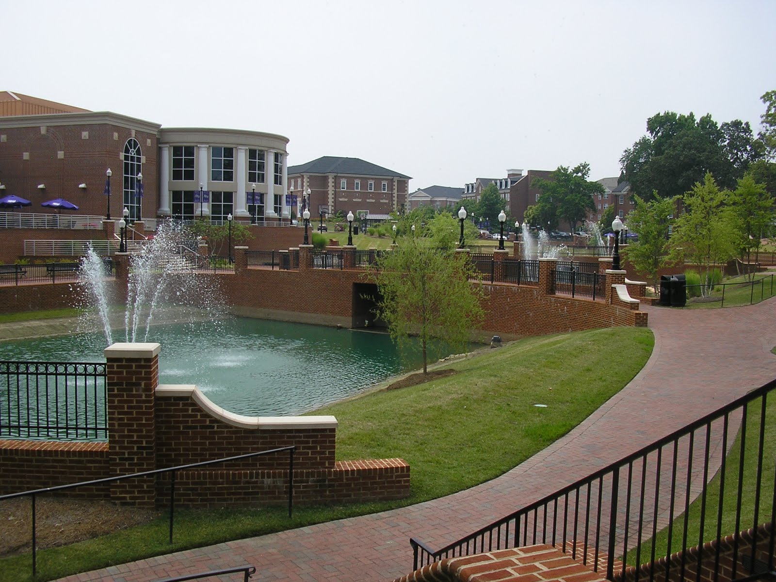
Today was a particularly hot day outside. I hit a number of caches in High Point, NC. My favorite ones were along the greenway starting at Armstrong Park. I started down the greenway and came to the ball field. Immediately I recognized it from the last time I was there back in 1966! This is the ball field where I played many of my little league games when I was in the sixth grade. I have fond memories of that place and those days. Being so young I didn't remember where the field was other than that it was in High Point. Our team was called the McDonald Cubs. We were sponsored by McDonald's back before the Big Mac. I recall that after each game we won the whole team got to go to McDonald's on Main Street for a coke, hamburger and fries. That was a big treat! Thanks to caching I was able to rediscover that piece of my past. I found Sitting by the Creek (GC1PRZT) and signed the log before heading further east along the greenway. After one more cache I was on the High Point University campus. What a beautiful campus with its red brick buildings, fountains and sculptures. I found two more caches placed by students who are obviously proud of their school. On the way back to the greenway Curtis, a campus security officer, stopped and offered me a ride. It was great getting a little A/C for half a mile to the green way. Check out HPU when you can. You might check in with the campus security first. I noted that they were particularly vigilant.